Shatial Rock Art
Shatial, Khyber Pakhtunkhwa
Explore
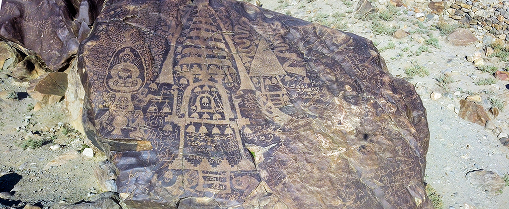
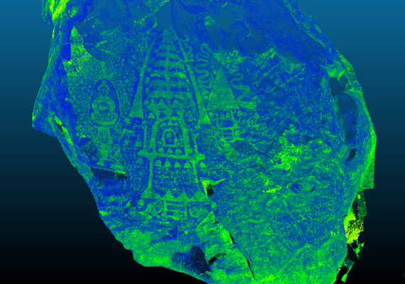
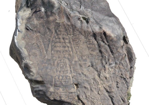
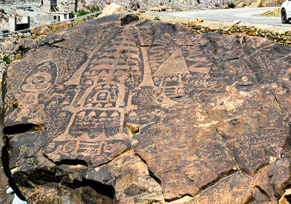
"A multicultural crossroads once connected South Asia with Central Asia at the “roof of the world” (bam-i duniya). Intertwined networks of capillary routes served as passageways through the Upper Indus River and its tributaries descending from the Western Himalayas and Karakorum mountains and directly connected the main arteries of the northwestern Indian subcontinent to the so-called Silk Routes in the Tarim Basin (see Maps 1-2). An amazing panorama of rock art and inscriptions at nodes of these routes reflects tremendous cultural, religious, and linguistic diversity in this pivotal transit zone. From prehistoric times and through the first millennium BCE and CE, visitors and local residents have drawn a wide range of images on rocks (petroglyphs) and have written their names with dates and donative formulae in inscriptions in Indian, Iranian, Tibetan, Chinese, and other languages and scripts. Tens of thousands of rock drawings and approximately five thousand inscriptions are abraded into the dark patina of high mountain desert varnish covering the rocks. These visual and written records created by local inhabitants and visitors demonstrate remarkable long-distance mobility, layers of regional cultural heritage, and varieties of symbols, languages, and writing systems. These records are local primary sources for understanding chronological patterns of regional history, visual and material cultures, linguistic and paleographical changes, cross-cultural exchanges, trade networks, and religious transmission. The proposed project to apply 3-D scanning technology to complexes with graffiti and petroglyphs will enhance efforts to preserve regional cultural heritage, make high quality documentation more widely accessible, advance scholarly and public understanding, and aid in promoting the development of cultural tourism. There is timely need for such a project due to plans for constructing a large hydroelectric dam on the upper Indus River at Bhasha, which if realized would submerge the majority of the eipigraphic and visual corpus in a large basin in the Chilas plain."
Prof. Jason Neelis.